Burntshields Burgher Church

In 1712 an Act was passed restoring patronage to the Church of Scotland. This meant that the patron of a parish church, usually the local Laird, and not the congregation chose the minister. Because of various unpopular settlements of ministers, dissenters (also know as seceeders) from seventeen parishes in Renfrewshire set up their own church at Burntshields on the hills above Kilbarchan. The original congregation included 78 members from Kilbarchan, 47 from Paisley, 20 from Houston, 32 from Killochries in Kilmacolm, 51 from Lochwinnoch, 7 from Kilbirnie, 3 from Beith and 82 from Greenock and Inverkip.

This church called Burntshields Burgher Church was built in 1745 and opened the following year. The walls were built by the members of the congregation and the rafters were dragged up from the Clyde shore by horses. The church had seating for 600 and was referred to as the Big Sclate Hoose – so presumably had a slate roof, a novelty at the time among the thatched roofs of the ordinary houses. This was the first seceeders’ church to be built west of Glasgow.

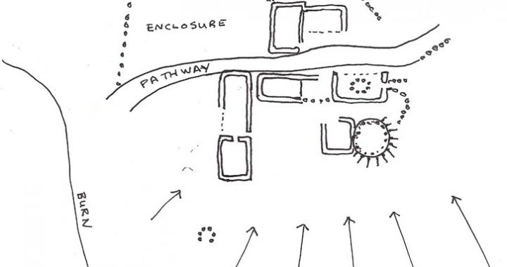
The church was situated in Minister’s Lane on the north of Burntshields Road, the road leading from Kilbarchan to Lochwinnoch. The manse was across the lane from the church. Burntshields Burgher Church ran its own school in a nearby barn. This school was still in existence as a country school long after the church closed in 1826.

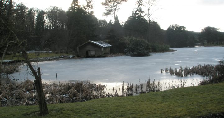
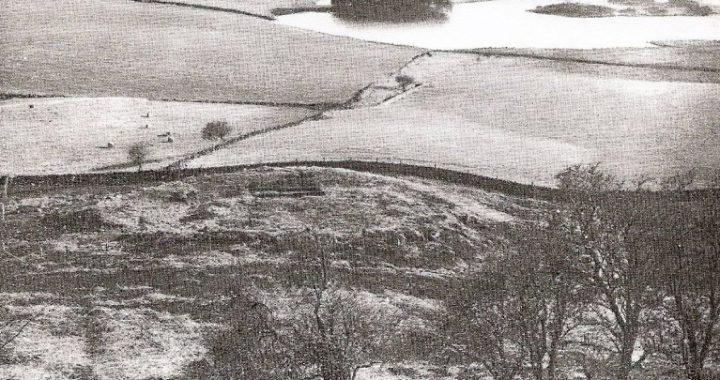
Little evidence of the church remains today. A memorial obelisk to the church is now in the garden of nearby Burntshields Cottage and old gravestones are rather irreverently incorporated in the garden wall.

In 1790s there was some dissension in the church and the congregation split. In 1792 one group removed to Johnstone with the Rev.Lindsay. This was the origin of St Paul’s Church in Johnstone. Another group moved to Lochwinnoch to set up a new church there (later to become Calder Church). The third group remained at Burntshields.

In 1826 the Burntshields Church closed and the congregation moved from the country district and set up a new chapel, in Bridge of Weir, where there was much need of a church due to the rapid increase in the population after the establishment of cotton mills on the Gryffe. This chapel was to become Freeland Church, in Bridge of Weir.

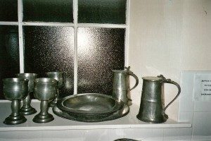
Two square rather ornate communion tokens from Burntshields Church, both dated 1793, are in the collections of Paisley Museum. One token is in almost mint condition. In 1971 the Burntshields communion service, which was discovered in an old basket in a loft where it had lain forgotten for years, was given to Freeland Church in Bridge of Weir . The inscription round each flagons reads ‘GIFTED TO THE ASSOCIATE CONGREGATION OF BRWNTSHIELDS AWGUST 1769’ and the inscription on each cup reads ‘BELONGING TO THE ASSOCIATE SESSION OF BURNTSHIELDS 1774’.

© 2010, Helen Calcluth

Glentyan Estate, Kilbarchan

‘Not many estates of like size can boast such varied beauty as Glentyan.
To the painter, or landscape photographer, it is good hunting ground at all seasons of the year’.

James Wright 1929

James Wright’s statement is still true today. The beauty of Glentyan Estate is undiminished  –  lawns and woodland paths, redwoods and a magnificent ancient beech tree, said to be 400 years old, the lake with nesting swans, the occasional roe deer leaping through the woods and Kilbarchan Burn cascading through the woodlands from the lake.

Glentyan Estate lies to the west of Kilbarchan, with its entrance drive at the bottom of Church Street. Evidence of its history is no less fascinating than its beauty  –  the Georgian mansion house, the ruins of an old mill, the mill dam, the remains of old lades, old bridges over the burn,  and an ice-house possibly dating from the late 1700s.

glentyanhouseGlentyan House

(Click on image to enlarge)

Glentyan House was built in the late eighteenth century by Alexander Speirs, a second generation linen merchant. In 1818 the estate was sold to Captain James Stirling who lived in Glentyan House for over fifty years. He was a popular local laird and a generous benefactor to the poor in times of need. After Captain Stirling’s death, the estate was sold to Thomas Mann. Unfortunately, Mr Mann was not so popular and numerous disputes arose with the villagers. The most notable was the famous right-of–way case in the early 1880s when the villagers took Mann to court over their right to use an old track through the estate. Mann eventually won the case in the House of Lords and the right-of-way was closed. It was replaced with a new right-of-way. This new right-of–way, the Dampton Pad, is still a pleasant country walk today.

In 1898 the estate was bought by Richard Hunter. Like Captain Stirling before him, he became involved in the affairs of the village. Richard Hunter is probably best remembered for the Glentyan Fete held on the Estate in 1929. The success of the fete led to the revival of Lilias Day in the 1930s. From the mid-twentieth century the owners of Glentyan Estate were in turn Duncan Leggat and then the Stakis family. The present proprietor is Andros Stakis.

Renfrewshire Local History Forum’s publication, ‘Glentyan Estate and its significance on the History of Kilbarchan’ is the third book in our Kilbarchan Toun Series. The book gives a history of the Glentyan Estate and its owners and their impact on the life of the village. It is well-researched and includes a number of photographs, drawings and maps. The final chapter deals with archaeological remains on the estate.

© 2010Helen Calcluth


Accident at New Moss Pit, 1873

A fatal accident happened at New Moss Pit on the morning of Saturday 20th May 1873. The pit was one of several ironstone mines in the Johnstone/Linwood area owned by the ironmasters, Merry & Cunninghame. That business had been formed in 1843 by James Merry (1805-77) and his partner, Alexander Cunninghame of Craigends. The partnership became a limited company in 1872, with John Cunninghame, nephew of the co-founder as a director.

As mining accidents go, this one at New Moss Pit wasn’t a bad one. “Only” five miners were involved and of these “only” two died as a result of their injuries. The five miners involved in the accident were James Stafford, High Street, William Reid, Dimity Street, Alexander Young, New Street, Henry Howard, Collier Street – all in Johnstone – and James Cain from Overton. They had gone down the pit on the morning of Saturday 20th September, to relieve the previous shift who had taken a 25lb barrel of blasting powder into the pit with them but had not used any of it.

The five men on the morning shift found loose powder near the barrel and, after collecting it up, sat down to have a smoke before starting work. It is thought that one of them, while trimming his lamp, accidentally ignited some of the loose powder remaining and the whole barrel (25lbs) exploded.

James Stafford and William Reid died of their injuries in the Royal Alexandra Hospital in Paisley on Monday 22nd September. James Stafford’s wife, Marion Bell, was left a widow with seven children, the youngest being only 4 months old. William Reid’s widow Sarah, was only 20 and had no family. The couple had been married just under a year.

According to the summary of the report into this fatal accident by Mr W. Alexander, HM Inspector of Mines for the West of Scotland, three miners, the pit manager, the oversman and the fireman were all charged with contravening the terms of the 8th General Rule of the Coal Mines Regulation Act 1872, which had come into force on 1st January 1873. This Act applied to coal mines and “certain other mines”.

Its 8th General Rule related to gunpowder and blasting and decreed that gunpowder or other explosive or inflammable substances “shall not be taken into the mine, except in a case or canister containing not more than 4 pounds”. The three miners were each sentenced to be fined £2 or 30 days in prison; the manager was fined £10 pounds or 10 days’ imprisonment and the oversman £2 or 10 days’ imprisonment. The fireman was dismissed because of the short time he had acted as fireman.

This fatal accident is listed as Accident 10 on Schedule 2 of the List of Fatal Accidents in Ironstone Mines and Loss of Life therefrom, in the Western District of Scotland, during the Year 1873. However, there are two apparent discrepancies in Schedule 2. Firstly, the mine is referred to as Clippens No 3 mine and not New Moss Pit as named in then current newspaper articles. Secondly, the fatalities are listed as William Reid and Samuel Stafford but it was James Stafford, not his brother Samuel, who died on 22nd September 1873 of burns inflicted by the explosion. This is confirmed by James’s death certificate, which shows that, on 23rd September 1873, Samuel Stafford notified the Paisley Registrar of his brother James’s death. Samuel, my great-great grandfather, did not die until January 1881.

© Georgina P. Fisher
Johnstone History Society

The Tower at Milliken – A hidden gem

milliken

A mysterious old tower, reminiscent of Rapunzel’s tower in the fairy tale, stands on the old Milliken Estate. It can be seen in the distance on the right across the bypass when walking along the cycle track from Johnstone to Kilbarchan. But what is it? Why is it there? Who built it?

Milliken Estate, covering several hundred acres of farmland between Johnstone and Brookfield, was developed in the early eighteenth century by James Milliken, a wealthy West Indies sugar planter. The land for Milliken Estate, formerly the Lands of Johnstone, was owned by George Houston of Johnstone Castle. This castle was the original Johnstone Castle, not the Houston’s later Johnstone Castle whose tower still survives in Tower Place.

In the 1720s the land for Milliken Estate, including the old Castle of Johnstone, was purchased, on Milliken’s behalf, by his friend William McDowall of Castle Semple, another West Indian plantation owner. The land was farmland and lay open and unenclosed. In 1728 the surveyor John Watt, an uncle of James Watt the steam engine pioneer, was employed to lay out a planned estate at Milliken. At the heart of the new estate was a country villa, built in the Glasgow merchant style.

In the spring of 1729, Milliken returned to Scotland with his family, a very rich man after 30 years on the Leeward Islands of St Kitts and Nevis. He demolished the old Johnstone Castle near Brookfield, and moved into his new mansion, Milliken House. This mansion house was unfortunately destroyed by fire in 1801, and was replaced on a different site by a second Milliken House in 1836. This second Milliken House was demolished early in the twentieth century.

Milliken Estate survives mostly as farmland, and there is little left to remind us of the Millikens. One of the few original features from the eighteenth century planned estate is this mysterious circular tower. The tower was the Milliken Estate doocot. Inside the circular walls are a thousand stone nesting boxes for the birds. The doocot was built to keep pigeons destined for the Millikens’ winter larder.

© Stuart Nisbet 2010                                                                      ( Click on image to enlarge )

An Excavation at Knapps

This photograph taken from the edge of Kilmacolm Golf Course during the excavation, is reproduced with the kind permission of Mrs Catherine Newall . Today the site is encircled by a planting of fir trees.

Near Knapps Loch, which lies just north of the road as you enter Kilmacolm from the Bridge of Weir, there is a round mound, marked ‘homestead’ on modern maps. It lies hidden behind a stone dyke at the top of a field on the north of the loch. It is easily spotted in winter and spring, but is more difficult to find in summer when it is covered in bracken. The late Frank Newall led an excavation at the site and his report (1965) gives information on people living on the mound in both pre-historic and medieval times.

The mound was first settled by Neolithic farmers. A large sub-rectangular building and three hut dwellings were built on top of the mound. The large building was supported by six major wooden posts. Its walls were made of brushwood and small branches and there were hearths inside the structure. The settlement was enclosed by a wooden fence or palisade. Two flint knives, triangular quartz blades, flint and quartz scrapers, fragments of pottery and saddle querns were found. The querns were used to grind grain

The mound was again settled in 14th or 15th century as a farm or homestead encircled by a stone wall. Inside the wall there was a stone-built farmhouse with a byre attached. The building had a cobbled floor and the back wall was part of the surrounding circular wall. There was also a granary, a store house and a barn inside the circular enclosure. Finds from the medieval period include glazed pottery sherds, and fragments of two shale bracelets.

Local tradition has it that stones from the medieval farm buildings and enclosing wall were used to rebuild, or extend, Killallan Manse in 1635. The plans in Frank Newall’s excavation report show foundations of a seventeenth century rectangular stone building and, during the excavation, a heavy iron mason’s chisel and a Charles I coin considered to be dated 1632-38 were found. The report considers the building to have been a shelter for workmen when the stones were being removed to Killallan Manse.

However, a later additional scenario is worthy of consideration. The site has been referred to locally as the ‘Auld Kirkstead’ and, on a recently discovered survey from the 1730s by John Watt, a building marked ‘Old Church’ is shown on the site. Strangely no evidence of grave stones or other artefacts indicating use as a place of worship were found during the excavation. This presents a bit of an enigma.

After the restoration of Charles II in 1660 when bishops were re-imposed on the Church of Scotland, many of the congregation in Kilmacolm Parish joined their minister, James Alexander, and became Covenanters. Conventicles were held by the Covenanters in the locality, near Ladymuir. Could another secret meeting place of the Covenanters have been the ‘Auld Kirkstead’ on the mound at Knapps?

© Helen Calcluth, RLHF

Johnstone’s Smallest Square

Gordon Square with the gable end of the old Quarrelton School building

Situated at the corner of Beith Road and the Linn Brae, almost unnoticed, there is a seated area known as Gordon Square. It is small for a square, much smaller than the well-known Houston and Ludovic Squares, and many people may not recognise it as being worth much attention. This little square is dedicated to the memory of General Gordon of Khartoum! If you visit the square you will see a memorial tablet on the gable end of the old building which once was Quarrelton School.

General Gordon was born on 28th January, 1833, in Woolwich, England. He was the son of a Royal Artillery officer, and followed his father into the military life and had a distinguished military career. In 1862 he was sent to protect the European trading station of Shenghai from the Taiping Rebellion. After defeating the Taiping Emperor, Huing Hsui, he brought to an end the civil war which had raged in China for years.

In recognition of his service, Governor Li Hung Chang presented him with the highest honour possible in the Chinese Empire, the Order of the Yellow Jacket. With this accolade he became, with fifty nine others in the empire, second in rank to the Emperor himself. It was after this that he became known as George ‘Chinese’ Gordon.

He returned to England and was stationed at Gravesend. During this time his father became very ill. His father’s illness affected him greatly and he entered a stage in his life where compassion and good works were a driving force. He personally nursed his father during the last days of his life. Later he did some teaching in the local Ragged School, he nursed, clothed and fed the sick and opened up army land for the poor to farm. He set up pensions for several elderly people and it is believed that he gave away ninety per cent of his army stipend. This he continued to do until his death at the Battle of Khartoum. Along with his entire garrison, he was killed on 26th January, 1885, two days before his fifty second birthday.

But what is the connection with Johnstone? The Laird of Johnstone, George Ludovic Houstoun, had met General Gordon and had corresponded with him during his many travels. Saddened by General Gordon’s death, the Laird had the square built in ‘a tranquil tree-canopied setting’ to the memory of his friend.

© M. Parker 2010 Johnstone History Society.

The Deserted Settlement of Laigh Lawfield

A little east of High Lawfield Farm on the road from Kilmacolm to Houston, an old track winds down from the road to the ruins of Laigh Lawfield Farm and continues as a marked pathway to Knapps. Information from old maps and parish records establishes early settlement and land use at Lawfield.

The first direct evidence of a fermtoun or farm settlement at Lawfield is marked on Pont’s map in the late 16th century. By the 1730s, Lawfield had developed into three small settlements – Laigh Lawfield (the original settlement), High Lawfield and Gateside. Only High Lawfield exists today, but the ruins of the deserted settlement of Laigh Lawfield can still be seen.

At Laigh Lawfield (see sketch below) the foundations of at least half a dozen stone structures stand to height of little more than half a metre with about twenty well-established sycamore trees growing out of the ruined walls. The raised round platform on the south-east of the site was a mill powered by horses and it is possible that the u-shaped arrangement of stones to the south may be the remains of a corn kiln. The farm was deserted by the 1890s when the OS map shows no fully roofed buildings on the site.

From the mid-eighteenth to mid-nineteenth century High Lawfield was farmed by a family named Laird. Gateside, the smallest of the three farms, no longer existed during this period.

Laigh Lawfield was occupied by Allan Speir in 1731. The Horse Tax Records document David Scott as the farmer at Laigh Lawfield in 1797. He owned two working horses and paid a tax of four shillings. In 1841 another D. Scott, aged 55, with two agricultural labourers and two female servants, farmed Laigh Lawfield. 

© H. Calcluth 2010