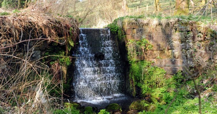
Apart from the Calder Water, several smaller burns feed Castle Semple Loch. On the north side, the Blackditch Burn was diverted by a small dam, to supply the ornamental fish ponds and cascades behind Castle Semple House. (See image above.)
At the north end of the loch, the Brides Burn enters the loch under Fancy Bridge at the beginning of the Black Cart. A short distance upstream was Brides Mill, a traditional grain mill.
Over the centuries, many schemes were devised to dam Castle Semple Loch at the beginning of the Black Cart. The earliest was in the medieval period, to power Auchendinan Mill. Later attempts to drain the loch deepened its outlet, leaving the mill high and dry. Today the flow in the Black Cart is controlled by a weir near the Elliston Burn, operated by Scottish Water.
The minor Elliston (or Linnister or Bowfield) Burn is spanned by Elliston Bridge, but the bridge’s name dates from a much larger bridge, which spanned the Black Cart. This old bridge was demolished in the 1780s and replaced by Garthland Bridge. Up in the headwaters of the Elliston Burn a large printfield was built at Bowfield in the 1780s. Further down, near Elliston Castle, was a Victorian sawmill.
Continuing down the Black Cart, old mill sites continue to be rediscovered. A 1730s survey shows a Waulk Mill for dressing woollen goods at Thirdpart. Apart from burns, the river is still fed by ‘levels’ (underground tunnels) which drain old coal and lime workings in the Corseford area. At Corseford the Swinetrees Burn was diverted in the 1770s to turn a waterwheel to drain lime workings. By the Victorian period, this water wheel drove Corseford grain mill. A large reservoir was built in the burn’s headwaters at Whittlemuir (now drained), below the Iron Age fort at Walls Hill. Along with the lesser Skiff Burn to the west, this stored water for Midtown Bleachfield, which had a large water wheel 11 metres in diameter, supplied by a long lade cutting across the hillside.
Further down the Cart a pair of traditional mills stood on either side of the river at Milliken Bridge. Milliken grain mill stood on the north side and, Cochrane Mill, which became a bleachfield in 1796 and later a threshing mill, stood on the south.
© 2016, Stuart Nisbet

