Field Trip – Derek Alexander – Saturday, 11th April, 2015 Lurg Moor Roman Fortlet

Total Station Survey Computer Data

Total Station Survey Computer Data

Lurg Moor Roman Fortlet is situated on moorland above Port Glasgow and is part of the western flank of the Antonine frontier. It probably housed a cavalry patrol and is the only visible Roman remains in Renfrewshire.

After a long uphill climb and negotiating a few barbed wire fences we arrived at the sight of Lurg Moor Roman Fortlet. Evidence of the turf rampart and ditch round the fortlet and the entrance causeway were clearly visible on the ground, but there was no evidence on the ground of the wooden barracks and stables built within the fortlet.

The weather was disappointing, very cold, with a few blinks of sunshine, and with strong winds blowing across the site from the west – but we carried on regardless! Out of interest Derek gave us instruction on the use of a Plane Table.  We then conducted a Total Station Survey of the site.

Plane Table with Total Station in background

Instructions in use of Plane Table

Total Station Survey at Lurg Moor, 2015

Derek at work on Total Station Survey


 lurg plane tableitems for website

Another Excavation at Paisley Abbey. 2015

Trench 2: volunteers at work

Trench 2: Volunteers at work

From 31st August to 7th September, 2015, twenty members of Renfrewshire Local History Forum acted as volunteers, assisting the fourth excavation led by Bob Will of GUARD on the grass area opposite Paisley Abbey. In the previous excavations the remains of medieval structures associated with the Abbey had been uncovered, including the outer surface of the Paisley Abbey Drain, a beautiful cobbled area and what was considered to be a slate oven used by the monks..

This year’s excavation, as part of Doors Open Day, aimed to investigate the survival of other archaeological remains on the site. Our members were busy all week – digging, washing finds and recording the remains of structures. Fortunately, the weather was fine and the excavation had an excellent response from an interested public. Visitors on the Saturday of Doors Open Day included more than two hundred children who visited the site with their parents.

Three trenches were dug on the site and we reached the foundation level of the late eighteenth and nineteenth century buildings in Abbey Close. Unfortunately, time did not allow for further excavation. However, at the foundation level of the houses, pottery finds from the Medieval period were found. These included (from left to right) glazed tiles, plain roof tiles, ridge tiles, a coin possibly dated to the sixteenth century, and part of a pot handle. This confirmed that the Abbey Close houses had most probably been built on the site of the medieval abbey buildings.

Medieval Pottery Finds

Medieval Pottery Finds

image

Part of Medieval Pot Handle

Alma and June washing finds

Maggie and Conor recording and drawing

Maggie and Conor recording and drawing

The Castle of Houston

Last month we saw how the old village of Houston was transformed into a new planned village from the 1780s. Directly to the east of the old village and church lay Houston House or Castle, which stood on a mound fronting a long avenue stretching down to the River Gryfe.

The tower is referred to as early as the 1460s, as the Nether Mains of Houston, with castle, woods and hunting grounds. By the seventeenth century the castle seems to have been of Disneyland style – a square tower, consisting of four sides around a central courtyard. The parapet overlooked the whole countryside from an elevated mound. The south or front elevation looked towards the River Gryfe and had two turrets, flanking an arched entrance with a portcullis. Underneath was a vaulted basement.

Due to the changes of owners and transformation of the estate around the time of the forming of the planned village, there was little evidence to confirm these descriptions. However the newly discovered estate plans, c.1780, show that the descriptions weren’t fantasy, but were in fact correct. They show a large square keep with a central courtyard, elevated on a mound. Even the turrets flanking the entrance can be seen on the plan.

The castle had a grand elevated setting, possibly on an earlier motte. It wassurrounded by parks and woodland. Around the house was a garden and bowling green. To one side was a ‘Pigeonhouse Park’ with a doocot. The great tree-lined avenue led south towards the River Gryfe.

By the 1780s towerhouses were in decline. Three sides of the castle were knocked down shortly after the survey was carried out, and the stone was allegedly used to clad the fronts of the new houses in Houston village. By this time the castle was described as being ‘once a large and very ancient mansion overlooking the whole country, from one of the finest spots’. By that time, only the east wing of the castle remained, but in a ruined condition, only big enough ‘to accommodate any ordinary family’.

© 2015, Stuart Nisbet, Renfrewshire Local History Forum

NOTES;     On the plan above  “Houstown” is the old castle

The large image above the title is of Houston House today, built on the site of the old castle.

The Old Village of Houston

Houston village was traditionally one of the seventeen parish villages or kirktouns in Renfrewshire. From the middle of the eighteenth century, Houston estate passed from the Houston family through various owners, the most wealthy of whom were colonial planters, including one from Jamaica, and another who was an island Governor. The biggest changes to the village occurred from the 1780s, again with sugar and tobacco money, when the whole estate was purchase by another colonial merchant, Archibald Speirs of Elderslie.

Speirs carried out a survey of his whole Houston estate, which comprised more than a thousand acres of Houston parish situated along the Gryfe Water, and north towards Barochan and Kilmacolm. The proposal was to improve the lands and also to create a new planned village. Building commenced in 1781 and two streets were laid out, parallel with the Houston Burn.

Unlike Bridge of Weir and Crosslee nearby, Houston has no river running through it. Despite this, and the rural situation, the very modest Houston Burn was managed to provide power and process water for at least five new industries to provide employment in the new village. Reservoirs were built further up the burn to store water. Four bleachfields were laid out along the burn. The largest, just west of the new village, was owned by the Carlisle family of Paisley, and whitened cotton yarn, sewing thread, muslins and lawns.

In the early 1790s, Paisley merchant Robert Park purchased land beside the avenue of Houston House, including Gardeners Acre, Goosebutts, Milnhouse and Saughfence Parks. Part of the area was flooded to create a reservoir, and
a lade was diverted off the burn to create a fall of thirty feet. This drove a water wheel, which powered a cotton spinning mill, four storeys high and a hundred feet long, employing 140 locals. Textile manufacture also provided the main employment in the village itself, with 42 looms in private houses, weaving cotton, muslin, lawn and silk gauze. There was also a small centralised ‘factory’ or weaving shop where handloom weavers wove expensive fabrics. In its first decade, the village population rose from sixteen families to fifty seven.

image

The plan shows the pre-1780 Houston village.

 “Houstown” is the old castle

The downside to the new planned village was that we have little record of the earlier pre-improvement village. Fortunately, in recent years, the estate plans surveyed c.1780 have been rediscovered. More than a dozen colour plans show each farm on the estate, plus the old village, just before the new village was laid out. They show the old village of Houston, including the school and two pubs, clustered around the market cross and the parish kirk, which had been rebuilt in 1775.

The Houston estate plans, can be viewed at the National Library of Scotland or by contacting RLHF.

© 2015 Stuart Nisbet, Renfrewshire Local History Forum

The Great Drain Archaeological Dig

PaisleyAbbeyCome and discover more about Paisley Abbey as GUARD Archaeology’s research continues and Paisley’s fascinating story unfolds. Led by GUARD Archaeologist, Bob Will, a team of local volunteers will be seeking to uncover more secrets about Paisley’s historic past.

The team will be on site from Monday 31st August until Sunday 6th September 2015. The project is being run in conjunction with Renfrewshire Council and the Renfrewshire Local History Forum.

The Great Drain of Paisley Abbey is the best preserved monastic drain in Scotland with a unique assemblage of archaeological evidence. This ranges from medieval pottery and fragments of slate inscribed with music and poetry, to seeds and animal bones, revealing much about the medieval monastic community and its links with Europe when it was a leading centre of the Benedictine Order of Cluny.


Taken from GUARD Archaeology’s post at http://www.guard-archaeology.co.uk/news15/PaisleyAbbeyNews.html
locherfield

Locherfield Bleachworks

In a spell of dry weather in the summer of 2014 the flow of the Locher Water (between Kilbarchan and Bridge of Weir) was reduced to a trickle. This revealed the footings of what appeared to have been an old weir or dam with the timbers preserved by decades of immersion in water. The weir or dam, constructed in the early 1860s, was associated with Locherfield Bleach Works which was owned by Hardie, Starke & Co. Forum members have been investigating the site and its history.
This field survey into the remains of the bleach works is continuing and a second weir has been revealed on the bank of the river further downstream where a large spill tunnel exits into the river.

Excavation at Greenbank House

On Sunday, 27th of July, 2014, the Forum had a stall at Archaeology Day at Greenbank House and Gardens. The event was run by the National Trust for Scotland. Derek Alexander of NTS organised the dig. Four of our members and interested teenager, Conor Brett, were volunteers in a small excavation of three trenches in different parts of the gardens.

Trench 1 was the site of a saw mill and Trench 3 was an attempt to find building foundations.

Maggie examining a five inch layer  of greyish ash at sawmill site Trench 1

Maggie examining a five inch layer of greyish ash at sawmill site Trench 1


Maggie, Conor and Bill in Trench 2

Maggie, Conor and Bill in Trench 2

William Hair, Kilbarchan emigrant to Ulster and America

William Hair was one of the earliest Kilbarchan men known to have settled in America. He was born in Kilbarchan 1694, the youngest of the four sons of William Hair and Margaret Gardiner. His father was a tenant farmer in Birdland who paid a total of one pound and three shillings in Poll Tax in 1695. Previously the family had lived in Weitlands (Wheatlands). At this time both settlements were fermtouns, small farming settlements usually tenanted by more than one family. Wheatlands still exists today, but Birdland (variously spelled Boreland and Boarland) is long gone.

As a young man William Hair, like many Scots, moved to Ulster where he worked as a farm labourer. This move was not as successful as he had hoped and William became disillusioned. He and a companion John Paterson, who may have been a John Paterson born at Locherside in Kilbarchan Parish in 1693, set sail from Londonderry on a ship bound for Boston, America, captained by a Captain Dennis.

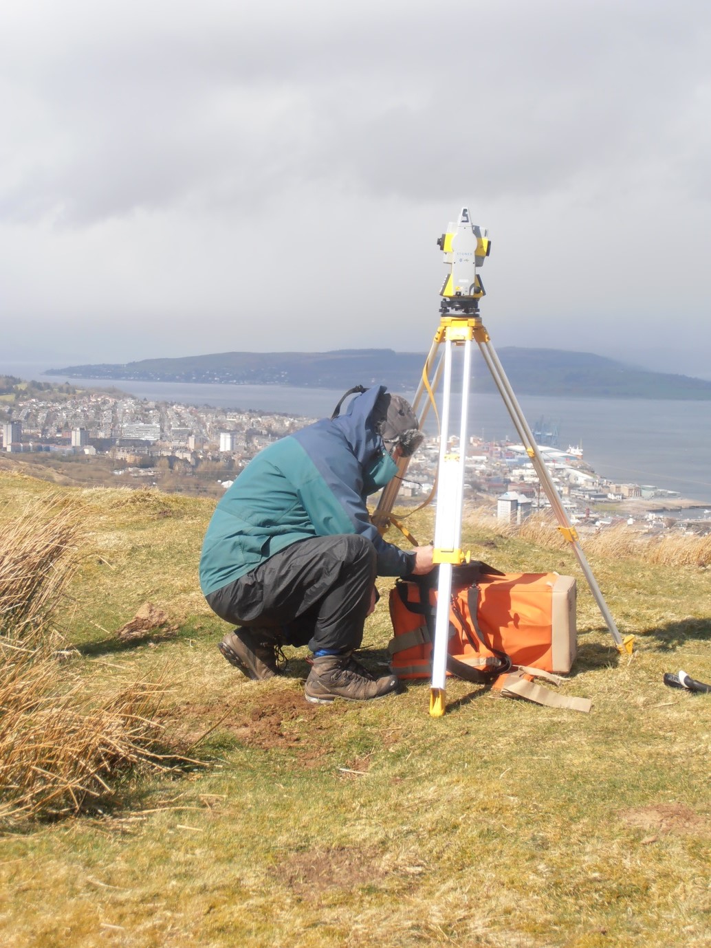
In 1719 William and John are recorded as single farmers from Ireland who had recently arrived in the town. However, Boston did not want to support jobless new arrivals. William Hair, now in his mid-twenties, and John Paterson were chased out of town because they were single and jobless. From there, they made their way to Providence and then inland to Brookfield, still in Massechusetts, where new arrivals were made more welcome. In 1720 they were granted a sixty acre lot of land in the north of Brookfield beside Five Mile River, where they set up a Fulling Mill. William built his house on the site. In his youth William may have had some knowledge or experience in this early-mechanised industry in one of the two fulling mills (known as waulkmills in Scotland) on the Black Cart near Kilbarchan.

William Hair was married three times and, between 1725 and 1755, fathered a large family of seven sons and seven daughters. When he married his first wife Elizabeth Owen in 1725, he was designated ‘a clothier, and first of the name in Brookfield’. Elizabeth was only fourteen years old when they married. Sadly, in the same year their first child Jane died in infancy. John Paterson and his wife Mary had a son John, born in 1724, and a daughter, Margaret born in 1726.

Both men still resided in Brookfield in 1748 when sixty-six tax-payers signed a petition to the Town Clerk of Brookfield asking for a second precinct with Parish privileges and a meeting house to be set up in the north of the town. Among the signatories were William Hair, John Paterson, sen., and John Paterson, jun. The proposal in the petition was rejected and after continued pressure the matter went to the House of Representatives, on March 25th, 1750. Eventually in 1754 an Act was passed, establishing the new Precinct. A congregational Meeting House was built and a Mr Forbush was appointed as minister.

William’s large family and their descendants, like most eighteenth century Americans, volunteered in the various American conflicts and wars which ravaged the country. Some family members were active in the frontier wars against the native Indians. William’s three eldest sons, Abraham, John and William fought for the British troops in the wars against the French in the 1750s. Twenty years later Abraham Hair fought against the British in the American War of Independence. John Paterson, jun. also fought for independence as a volunteer from Brookfield in Captain Nathan Hamilton’s company stationed at Ticonderoga Mills in 1776-7. In 1786, after Independence had been won, Hair family members supported local Brookfield man, Daniel Shay, in an insurrection by Massachusetts veterans and farmers to address economic grievances. This was known as Shay’s Rebellion.

Despite ancient wars and conflicts, descendants of William Hair from Kilbarchan still live in New England almost 300 years after William Hair arrived in Boston. Research into the family was inspired by an enquiry, to Renfrewshire Local History Forum from a descendant, Richard Hare of New York who, perhaps following the family tradition, was a USAF Captain in Vietnam.

© 2014 Helen Calcluth
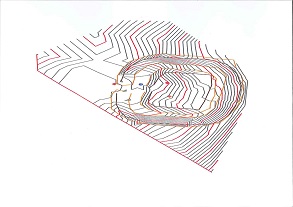
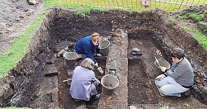
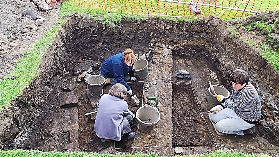
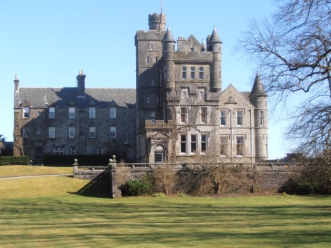
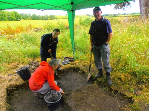
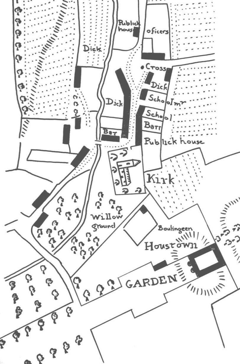
Robert Semple – A Kilbarchan Man and the Bargarran Witches of 1697

In the last decade of the 19th century an old weaver in Kilbarchan was heard to say ‘I knew a man who knew a man who saw the last witch burnt in Paisley’. He was referring to a man who witnessed the burning of the Bargarran Witches in Paisley in 1697.  It seems unlikely that this statement could be true two hundred years after the event. The question is  –  who was this man who witnessed the burning of the witches?

In 1697, when the witch trial and the burning of the witches took place in Paisley, there was still a strong belief in witchcraft and a widespread fear of witches. The trial came about because Christine Shaw, the eleven year old daughter of John Shaw of Bargarran in Erskine Parish, was suffering various torments and was believed to have been bewitched by one of her father’s servants and other local people. The Presbytery of Paisley was determined to eradicate all superstitions and witchcraft and local ministers, doctors and the gentry were consulted. They were all of the opinion that the child was certainly bewitched. This led to the trial in Paisley where seven innocent people were accused of witchcraft. The seven “Bargarran witches” were found guilty and condemned to death. One subsequently committed suicide by hanging himself in his prison cell. The other six were hanged and burnt on Gallow Green in Paisley. Although this event was not in fact the last sentence of death for witchcraft, it is generally regarded as the last mass execution of Witches in Western Europe.

At the time a ten year old boy, Robert Semple, was staying with his parents, the Semples of Belltrees, in Pollock Castle the home of his uncle Sir William Pollock. The hanging and the burning of the Barragan Witches was scheduled to take place on Gallow Green in Paisley on the 10th of June, 1697, and young Robert was keen to witness the spectacle. To prevent him from going, his parents hid his shoes. However, this didn’t stop him. He managed to leave the house, and walk barefoot to Paisley where he joined the immense crowd who had gathered to watch the spectacle. The memory of this eventful day stayed with him all his life and was a tale often recounted in his old age.

But where’s the Kilbarchan connection?  In 1777 Robert Semple bought land on what was then part of Milliken Estate in Kilbarchan and built Belltrees Cottage, naming it after his family’s former estate.

Beltrees Cottage today

Robert died in Belltrees Cottage in 1789 at the ripe old age of one hundred and two. Robert Semple was the Kilbarchan man who had witnessed the burning of the witches. His longevity gives credibility to the old weaver’s assertion, ‘I knew a man who knew a man who saw the last witch burnt in Paisley’.

© 2014, Helen Calcluth

Eaglesham Orry

eagle1Renfrewshire Local History Forum has introduced a new series of archaeology fieldtrips in the ‘Old Renfrewshire’. Our first archaeology walk in the series took place in Eaglesham and was led by Susan Hunter, a member of the Forum and of the Association of Certificated Field Archaeologists.

Susan started the walk at Glasgow Street at the bottom of the Orry, an A-shaped green area in the centre of the Eaglesham village covering 15 acres, bordered on the north by Montgomery Street and on the south by Polnoon Street. The Orry was gifted to the inhabitants of Eaglesham in the late 18th century by the 10th Earl of Eglinton as part of his planned village.

Susan pointed out areas of archaeological and historic interest as we made our way up the length of the Orry – the sites of old lades, tunnels and reservoirs on the Kikton Burn, old field boundaries , Moat Hill which was an early meeting place for judicial and other assemblies, Mid Road Bridge which was rebuilt by the feuars in 1835, and sites recently identified by geo-phys surveys where old buildings formerly stood.

However, the highlight of the day was the site and archaeological remains of the New Orry Cotton Mill built in the middle of the Orry, probably in 1791. The mill was the principal employer in Eaglesham for more than seventy years with as many as 200 employees in 1845. The main building was an impressive five storeys high. The mill’s history ended when it was destroyed by fire in 1876.

The walk up the Orry ended at the site of the Earl of Eglinton’s dog kennels. We then visited the site of an of an older cotton mill built in the late eighteenth century at Townhead at the top of the old village. Finally, we walked down Montgomery Street to visit the churchyard to see the Covenanter Memorial, commemorating the killing of martyrs Robert Lochkhart and Gabriel Thomson, who were put to death by the Highland Dragoons after attending a conventicle meeting in 1685.

Everyone attending the fieldtrip found this a most interesting and enjoyable day. We hope over the coming months to continue this series of walks in the local Strathgryffe area.

Some members of our group gathering outside the Eglinton Arms

Some members of our group gathering outside the Eglinton Arms